


Garmin
Garmin GPSMAP 722 Chartplotter with 7 inch Touchscreen
Pickup available at Mercury Yacht Harbour
Usually ready in 2-4 days
Description
The Garmin GPSMAP 722 is a 7 inch touchscreen chartplotter built for serious navigation. Its bright, sunlight readable WVGA display and intuitive touch interface make it easy to plan routes, mark waypoints and view detailed charts, while the internal 10 Hz GPS/GLONASS receiver updates your position and heading ten times per second for smooth, accurate tracking.
Preloaded with a worldwide basemap and ready for BlueChart g3 and LakeVu cartography, the 722 connects to the wider Garmin system through the Garmin Marine Network, NMEA 2000, NMEA 0183 and built in Wi-Fi. Add radar, autopilot, sensors and the ActiveCaptain app to build a fully integrated helm. This is the chart only model with no built in sonar.
PRODUCT DETAILS
- 7 inch sunlight readable WVGA touchscreen, 800 x 480 resolution
- Internal 10 Hz GPS/GLONASS receiver for precise position and heading
- Preloaded worldwide basemap, ready for BlueChart g3 and LakeVu charts
- Connects via Garmin Marine Network, NMEA 2000, NMEA 0183 and Wi-Fi
- Supports radar, autopilot, sensors and the ActiveCaptain app
- Chart only model, no built in sonar (networked sonar supported)
- Rugged IPX7 waterproof housing with two SD card slots
No exploded diagram available for this product.
No compatible transducers listed for this product.
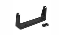
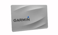
No compatible products found.
Display
| Display size | 15.4 x 8.6 cm (6.1 x 3.4 in.), 7 in. diagonal |
| Display resolution | WVGA, 800 x 480 pixels |
| Display type | Colour touchscreen |
GPS/GNSS
| GPS receiver | Internal 10 Hz GPS/GLONASS |
| Preloaded charts | Worldwide basemap |
| Waypoints / routes / tracks | 5,000 waypoints; 100 routes; 50,000 track points, 50 saved tracks |
General
| Built-in sonar | None; networked sonar supported via compatible Garmin module or transducer |
Connectivity
| Networking | Garmin Marine Network, NMEA 2000, NMEA 0183, Wi-Fi |
| Wireless frequency | 2.4 GHz @ 17.6 dBm maximum |
| NMEA 2000 LEN | 2 @ 9 Vdc (75 mA max.) |
| Memory card | 2 SD card slots; 32 GB max. card size |
Physical
| Dimensions (W x H x D) | 22.4 x 14.3 x 5.4 cm (8.8 x 5.6 x 2.1 in.) |
| Weight | 0.86 kg (1.9 lb.) |
| Material | Polycarbonate plastic and die-cast aluminium |
| Compass-safe distance | 71 cm (28 in.) |
Electrical
| Input voltage | 10 to 32 Vdc |
| Max. power usage at 10 Vdc | 24 W |
| Typical current draw at 12 Vdc | 1.5 A |
| Max. current draw at 12 Vdc | 2.0 A |
| Fuse | 6 A, 125 V fast-acting |
Environmental
| Water rating | IEC 60529 IPX7 |
| Temperature range | -15 to 55 C (5 to 131 F) |
No videos available for this product.
No downloads available for this product.
No frequently asked questions for this product.

