

Raymarine
CHARTS - LIGHTHOUSE US GOVT ENC iENC VEC
Pickup available at Mercury Yacht Harbour
Usually ready in 2-4 days
Raymarine cover is 2 years (3 with 90-day registration). Add 1 or 2 more years with HME Care Plus.
Extended cover is added to your order and confirmed with your warranty documentation.
Description
Navigate United States Government (ENC / Inland ENC) with Raymarine LightHouse Charts, the company's own next-generation marine cartography for Axiom and Element chartplotters. This region is supplied preloaded on a microSD card, ready to insert and chart straight away.
LightHouse Charts GEN 2 are created from official hydrographic chart sources, so the depths, hazards and aids to navigation you rely on come from the same data trusted by maritime professionals. Redraw and zoom are up to three times faster than the previous generation, and you can toggle between the information-rich LightHouse Leisure style and the professional S-52 Government style to suit how you like to read a chart. Day, SuperDay, Dusk and Night palettes keep the display clear as the light changes.
Coverage: United States Government Electronic Navigational Chart (ENC) and Inland ENC vector coverage for U.S. coastal and inland waters.
A 12-month LightHouse Charts Premium voucher is included, giving you chart updates plus access to Mapbox satellite imagery and an expanding points-of-interest library. LightHouse Charts are compatible with Raymarine Axiom and Element chartplotters only.
PRODUCT DETAILS
- Preloaded microSD-card coverage for the United States Government (ENC / Inland ENC) region
- LightHouse Charts GEN 2 cartography for Raymarine Axiom and Element chartplotters
- Built from official hydrographic chart sources for trusted, professional-grade accuracy
- Up to 3x faster chart redraw and zoom than the previous generation
- Switch between the information-rich LightHouse Leisure style and the professional S-52 Government style
- Day, SuperDay, Dusk and Night colour palettes for clear viewing in any light
- Adjustable chart symbol sizing for channel markers, points of interest and other icons
- Includes a 12-month LightHouse Charts Premium voucher for chart updates and satellite/POI content
- LightHouse Charts United States Government (ENC / Inland ENC) preloaded on a microSD card
- 12-month LightHouse Charts Premium subscription voucher code
No exploded diagram available for this product.
No compatible transducers listed for this product.
No spares or accessories listed for this product.
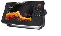
Raymarine Element 9 HV Chartplotter with HyperVision Sonar
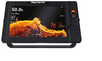
Raymarine Element 12 HV Chartplotter with HyperVision Sonar
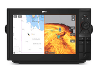
Raymarine Axiom 2 Pro 9 RVM
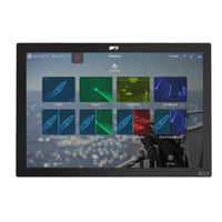
Raymarine Axiom 2 XL 24 Chartplotter
Raymarine Axiom 2 Pro 16 S
Raymarine Axiom 2 Pro 12 RVM
Raymarine Element 9 S Chartplotter with CHIRP Sonar
Raymarine Axiom 2 Pro 9 S
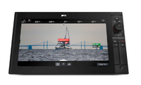
Raymarine Axiom 2 Pro 16 RVM
Raymarine Axiom 2 XL 16 Chartplotter
Raymarine Axiom 2 XL 22 Chartplotter
Raymarine Axiom 2 XL 19 Chartplotter
Raymarine Element 7 S Chartplotter with CHIRP Sonar
Raymarine Element 7 HV Chartplotter with HyperVision Sonar

Raymarine Axiom 2 Pro 12 S

Raymarine Element 12 S Chartplotter with CHIRP Sonar
General
| Product type | LightHouse Charts region card |
| Coverage region | United States Government (ENC / Inland ENC) |
| Coverage area | United States Government Electronic Navigational Chart (ENC) and Inland ENC vector coverage for U.S. coastal and inland waters. |
| Chart format | Raymarine LightHouse Charts GEN 2 (vector) |
| Chart styles | LightHouse Leisure and S-52 Government |
| Media | Preloaded microSD card |
| Data source | Official hydrographic chart sources |
Subscription
| Premium subscription | 12 months LightHouse Charts Premium included (voucher code) |
| Updates | Chart updates via LightHouse Charts Premium / Chart Manager |
Compatibility
| Compatible chartplotters | Raymarine Axiom and Element chartplotters only |
No downloads available for this product.

